Showing posts with label surface water. Show all posts

Wednesday, May 27, 2020

It's Water-Wise Wednesdays with Frannie the Fish! {Safety First!}

Summer is almost here! Parks, pools, lakes, and beaches are starting to open up again as lockdown restrictions ease and Frannie can't wait to get out there and play in them.
It's important to remember how to be safe around open waters so that we can have good, safe fun all summer long. With these few tips, you can join Frannie and her friends in the water!

  1. Use the buddy system. Stay near your buddy and be sure to let someone know if you or your buddy is lost or needs help. 
  2. In the same track as using the buddy system, make sure you stick together and stay close to the beach or shore where family, friends, or other adults can help you if you need it.
  3. Never drink the water from a stream, lake, river, or other water body you are playing in or investigating.  Even if it looks clean, it might not be healthy to drink.
  4. When playing on the banks of rivers, streams, ponds, and lakes, make sure the ground is sturdy and won’t give way. Look for signs of erosion that might indicate loose ground.
  5. Pay attention to your surroundings. Is the ground or the bottom of the lake or river rocky?  Is the current strong?  Is the water level high or low?  What is the forecast supposed to be today?  Are there any fast moving boats nearby? These are very important questions that only take a few minutes to think about but can make all the difference.
  6. There’s no such thing as bad weather, just bad clothing. Wear socks, long sleeves, and pants for hiking out to your favorite river or lake spot. Hats can protect you from the sun and bugs. Closed toed shoes can prevent rocks from cutting your feet. Flip flops are okay for the pool, but leave them at home for outdoor adventures.
  7. Know which plants are poisonous. Poison ivy, poison oak, and stinging nettles can all make you feel uncomfortable or make you really sick. Poison sumac and hemlock are not as common, but can also be a threat.
  8. Certain insects, such as ticks, mosquitoes, flies, bees, and hornets, can also ruin your nature experience.  Dress properly and wear insect repellent.
  9. Respect the environment. Remember that you are a guest. Take nothing but pictures and leave nothing but footprints.
Have fun and stay safe!

Wednesday, August 21, 2019

It's Water-Wise Wednesdays with Frannie the Fish! {The Water Cycle: Part 9 - Recharge}

This is the ninth and final part of Frannie’s exploration of the water cycle. Please check out her previous blog on the overview of the water cycle and her deep dives into groundwaterdischargesurface waterevaporationcondensation, precipitation, and runoff.
Welcome back to Frannie’s exploration of the water cycle! The final, red-colored bead on Frannie’s water cycle bracelet represents recharge, which is the process by which an aquifer takes in water. If you think of an aquifer like a phone battery, you know that when you use your phone, the battery gets depleted. In order to make your phone work again, you have to connect it a power source and charge it. Surface water, run off, and precipitations are kind of like power sources for an aquifer. Water seeps, or percolates, through the ground, recharging the aquifer once it reaches the water table.

The ability of an area to perform recharge depends on many factors like the type of soil and how well it can hold water, how much rain an area receives and where it fall, how steep the hills are in an area, and climate of an area during each season. For example, if rain falls on a steep city street, it won't be able to pass the impermeable pavement and will flow quickly downhill. However, if it lands in a flat area that has a type of soil that water can pass through quite easily, the water can infiltrate the unsaturated zone to reach the water table.

Frannie learned something interesting while researching recharge. Not all water that enters the soil actually becomes recharge. Much of it is stored in the unsaturated zone and returns through the atmosphere either through evaporation or by being drawn into plants’ roots and then transpired. This is in part due to water’s stickiness superpower from the deep dive into condensation.
But that’s not the only way that groundwater can be recharged. Human-induced recharge is water that is put back into the ground on purpose. Wells that do this are called injection wells, but it can also be directed into spreading basins. A spreading basin is an area that holds surface water long enough for it to seep into the ground, such as a wetland or marsh.

Groundwater recharge and the processes that allow it to happen are very important to the health of an aquifer. If too little recharge occurs over an extended period of time, such as in times of extreme drought, the aquifer can shrink. The sheer weight of the land can compress the dry soils and form impermeable barriers and the aquifer will never be able to return to its previous size. This is aquifer storage loss, a concept Frannie explored while “Seeing an Aquifer in Space”. 
Now that our water droplet has returned to groundwater, Frannie has completed this cycle. This isn’t the only loop a water droplet can take.

Sometimes, a water droplet with travel from the surface, condense and precipitate, land on a leaf and evaporate again before it ever has the chance to touch the ground.

Sometimes, water flowing in river will exchange back and forth with the groundwater flowing beneath the riverbed.

And sometimes, water will be pumped from the ground into your house, through your faucets and toilets and shower, treated in a septic system, and eventually released back into the ground.

Thank you for traveling with Frannie on her journey through the water cycle! She learned a lot along the way and hopes you did, too!

Wednesday, June 12, 2019

It's Water-Wise Wednesdays with Frannie the Fish! {The Water Cycle: Part 4 - Surface Water}

This is the fourth part of Frannie’s exploration of the water cycle. Please check out her previous blog on the overview of the water cycle and her deep dives into groundwater and discharge.


Welcome back to Frannie’s deep dive into the water cycle! Today’s focus is surface water. Frannie knows that groundwater refers to water under the ground, so surface water must refer to the bodies of water above the ground, on the surface of the earth. Streams, rivers, lakes, and oceans are all examples of surface water.

Frannie’s experiment with the Awesome Aquifer Kit and her deep dive into the discharge process taught her that surface water is connected to groundwater. Streams and rivers can exchange water droplets that flow with the main current with water droplets that make up the subsurface flow, or flow beneath the streambed.


While Frannie wasn’t surprised by her research into streams and lakes, she was surprised to find surface water hiding in wetlands and glaciers! Wetlands, like marshes and swamps and bogs, are very important locations for groundwater recharge, which Frannie will talk about more later.  Wetlands near the sea or ocean can be flooded and drained by tidal activity and become salt marshes. All kinds of wetlands are incredibly important to prevent flooding and protect water quality.


Frannie has never seen a glacier, but in her research, she learned that she could think of it as a large river of ice that flows downhill under its own weight. When areas have a lot of snowfall in the winter start to warm up, the snow begins to melt and compress itself. If an area receives more snow than it can melt away, the melting snow turns into ice and grows with more cycles of snowfall and partial melting, eventually forming a glacier. Glaciers have an enormous effect on the topography, or layout of the land, in a region as well as its quantity and quality of available water.

Join Frannie next time as she follows the water cycle from rivers, wetlands, and glaciers to the sky. See you then!

Wednesday, May 1, 2019

It's Water-Wise Wednesdays with Frannie the Fish! {The Water Cycle: Part 1 - An Overview}

The water cycle is probably something that you’ve already learned in school. You know that water goes into the sky, forms a cloud, and then comes down as rain or snow to re-enter the earth and do it all again.

But the water cycle isn’t as much of a circle as you might think. Sometimes a water droplet might go through a plant, into a glacier, or even enter your body when you take a drink on a hot day.

Frannie wants to take a closer look at the different parts of the water cycle over the next few weeks to get to know all the different paths a water droplet can take, but before we can do that, we should review the basics.

Do you have your water cycle bracelet you made two weeks ago? Great! You can use that to follow along as we review the parts of the water cycle.


Frannie’s bracelet starts with an orange bead, which means our first stop will be groundwater. Groundwater is the water that’s underground. It fills the empty spaces between gravel and soil and is found in many different soil layers. In the next blog, Frannie will dive down into those layers and talk about aquifers, storage, and flow.

The next bead is black, which represents discharge. When we’re talking about the water cycle, discharge simply means that groundwater leaves the ground and enters another part of the water cycle.  Many people know that groundwater discharge is connected to rivers and oceans, but did you know that it’s also connected to volcanoes?! Frannie can’t wait to show you how!

The third bead is light blue and represents surface water.  Defining this one is easy because it’s the water we see around us in puddles on the sidewalk, lakes, and in the ocean. But as you might know, surface water is intertwined with all parts of the water cycle. Frannie will swim through all kinds of surface water to show you just how strong those connections are.


Evaporation is the dark blue bead that comes next on the bracelet. Evaporation is the process of water going from a liquid state into a gaseous state. You can actually see evaporation happen when you make a cup of hot chocolate. When you mix hot water and hot chocolate mix in your cup, you still have the liquid form that makes up the hot chocolate that you drink. The steam that rises from the top is also water, but it’s been heated to the point that it turns into a gas.  Frannie will share a little bit about how the sun heats and evaporates surface water, but she is excited to also dive in to the lesser known processes of “evaporation” from plants and mountains.

Condensation is the white bead, chosen because the largest collections of condensed water float in the sky above our heads: clouds. Condensation has to do with one of water’s unique properties of adhesion, or stickiness. Water molecules really like to adhere, or stick, together. After the water vapor has risen into the sky, it cools down and is drawn together to form a cloud. But clouds don’t just stay in one place. If they did, it would be raining over the oceans all of time. Frannie wants you to help her explore how water is transported through the clouds.


The yellow bead represents precipitation, a part of the water cycle we all know and love.  Precipitation is a fancy word to describe any kind of water falling from the sky onto the ground. It’s rain! It’s snow! It’s hail and sleet and mist! Frannie will look at different types of precipitation as well as spending some time with a peculiar way water gets from the sky to the ground, a process called deposition.

The second to last bead, green this time, is our runoff bead. Runoff is water that drains or flows off of something, like when it rains on the top of hill and the water flows quickly towards the bottom. But what happens when precipitation doesn’t land on the ground or on surface water? What happens if it a rain drop falls on a leaf on the top of a tree or a snowflake stays on your eyelashes? Frannie isn’t sure, but she’s excited to find out.

The last bead on Frannie’s bracelet is red and the last blog in this series will talk about recharge. Recharge sounds like a confusing topic, but Frannie has a helpful analogy to clear it up for you. Imagine you have a phone that is at 100% battery. That phone is like an aquifer that’s completely full. When you use the phone, the battery storage is slowly used up. Using up energy from your phone battery is similar to when groundwater is discharged from an aquifer. When the phone battery gets low, you have to refill the battery. How do you do that? You charge it! Recharge is the process that refills groundwater so that it’s there for us to use again and again.  Recharge can be done naturally, like when rain seeps and percolates through the ground below. Frannie has also heard about something called artificial recharge, so she’ll do some research on that too.

So that’s the water cycle! It’s a bit longer and more complicated than you might have originally thought, but Frannie is excited to go on this learning journey with you.

If you’re excited to learn more about the water cycle, let us know on Facebook, Twitter, or Instagram!  See you next time when Frannie gets into groundwater!


Friday, September 28, 2018

BLOG: Nebraska Wellhead Protection Network

by Sara Brock, The Groundwater Foundation

The Nebraska Wellhead Protection Network is a collaboration of the Groundwater Foundation, state agencies, local municipalities, and private organizations who are involved in protecting and conserving groundwater and drinking water sources in Nebraska. A recent meeting was held on September 26, 2018 at the Water Treatment Plant in Auburn, Nebraska. Ken Swanson, manager of Auburn’s Water and Wastewater Treatment, and Dave Hunter, general manager of Auburn Board of Public Works, hosted the 24 of us inside Auburn’s Water Treatment Plant amidst all of the pumps, filters, and equipment.

Auburn’s public water system is supplied by groundwater from the alluvial aquifer underneath the Nemaha River valley and, because of this, is classified as “Groundwater Under the Direct Influence of Surface Water” or GWUDI. Communities that utilize GWUDI as a source have to have additional methods and treatments to ensure that the water that enters the public system meets all drinking water standards. The water treatment plant one part of Auburn’s complex and proactive approach to providing clean water in their area.  Fully automated, the plant self-cleans its filters, provides treated and safe water to all of its residents, and was designed to allow for additional filtering tanks and treatment processes should water quality and quantity issues arise in the future. While the filters were turned off during the presentation portion of the meeting, Ken and several of Auburn’s water operators were able to show us how the plant performs a filter flush and backwash during the tour.

Beyond the plant, Auburn has been working closely with the Nebraska Department of Environmental Quality to update their Wellhead Protection (WHP) Plan, including a re-drawing of the boundaries to include the Surface Water Contribution Area, encompassing a whopping 51,000 acres of land in and around Auburn. Dave’s presentation focused very passionately on the idea that groundwater and surface water protections absolutely must be integrated because “they all end up in the same bucket” and the 2017 version of the plan not only reflects this, but has also opened up Auburn’s WHP and Drinking Water Protection Management Plan (DWPMP) to new sources of funding. Auburn is the first municipality in the U.S. to utilize federal 319 funding for an integrated groundwater and surface water management plan.


The complex history and future plans of Auburn’s water system was a useful subject for many of the attendees of this meeting, including representatives from Syracuse, York, and Wilber.  These communities are in the process of developing and implementing wellhead protection and drinking water protection management plans. Talking with Ken and Dave as well as Jonathan Mohr, a senior environmental planner with JEO Consulting Group who assisted in the development of the plans, the meeting provided potential next steps and opportunities to replicate and improve upon Auburn’s WHP model.

For more information about the Nebraska Wellhead Protection Network, visit https://www.groundwater.org/action/community/newhp.html.

Tuesday, September 11, 2018

BLOG: Proactive Source Water Management for a Unique Water System

by Jonathan Mohr, JEO Consulting Group, Inc. and David Hunter, Auburn Board of Public Works

The City of Auburn, population 3,000, is located in southeast Nebraska, near the Little Nemaha River, approximately seven miles upstream of its confluence with the Missouri River. The City receives its drinking water from a wellfield located east of the community within an alluvial aquifer along the Little Nemaha River. The wellfield consists of 11 vertical wells averaging 45 to 50 feet below the ground's surface, pumping up to 150 million gallons per year. The source water area also includes multiple small perennial tributaries, which provide recharge to the aquifer, and are therefore hydrologically connected to the alluvial aquifer.


This connection has resulted in several unique water management challenges for the Auburn Board of Public Works (BPW), which is responsible for managing the community’s water system. This hydrologic connection resulted in a 2008 determination by the Nebraska Department of Health and Human Services that the water system is a “groundwater system under the influence of surface water.” Only 12 water systems in Nebraska (out of 602) carry this designation, which requires a higher level of water treatment. As a result, the BPW started construction of a new water treatment plan in 2009 which went online in 2011.

In order to better manage this unique resource, the BPW developed the Auburn Drinking Water Protection Management Plan (DWPMP) to guide decision-makers towards their goal of providing a long-term, safe, and reliable source of drinking water. The plan was approved by the Nebraska Department of Environmental Quality (NDEQ) and U.S. Environmental Protection Agency Region VII in July 2018, making Auburn the first municipality in the United States with an approved DWPMP.

The idea behind the DWPMP began in 2014 by the NDEQ Source Water Protection Program. NDEQ staff worked with U.S. EPA Region VII to recognize the hydrologic connection between surface water and groundwater. Historically, EPA has only focused funds towards protecting surface water quality; however, by recognizing this hydrologic connection and the risks to groundwater from nonpoint source pollution, NDEQ has opened the door to funding additional opportunities. NDEQ can now allow communities with an approved DWPMP to use funding from the Nonpoint Source Management Program 319 Funds to implement projects and programs to safeguard a groundwater-based drinking water source. Auburn’s DWPMP focuses on improving the water quality within the perennial streams that recharge the alluvial aquifer where Auburn’s wells are located.


A hydrologically connected aquifer requires a unique methodology to identify and delineate the wellhead protection area (WHPA). The former WHPA was updated to include a "conjunctive delineation" which identifies an area from which surface water may contribute to the groundwater reaching a well. Auburn’s conjunctive WHPA now includes the watersheds of the locally contributing tributaries, and a small portion of the Little Nemaha River watershed upgradient of the wellfield. This allows for holistic management and protection of both surface and groundwater resources. The new WHPA is 51,400 acres, one of the largest in Nebraska, and the first to be officially designated a conjunctive delineation by NDEQ.


Working with stakeholders and the public was critical to developing the DWPMP.  These included the Nemaha Natural Resources District (NRD), NDEQ, the Natural Resources Conservation Service, and private property owners. Stakeholders, including agricultural producers, provided input on preferred best management practices (BMPs), including cover crops, grassed waterways, no-till farming, soil sampling, and use of bioswales and constructed wetlands within urban areas.

Another key plan recommendation, currently under design by JEO Consulting Group, Inc., is exploring the use of artificial groundwater recharge (AGR) to increase the storage capacity of the aquifer. This could increase the quantity of water available to Auburn’s wells, build resistance to drought, and create a more sustainable and resilient water system. Structures used to achieve AGR will also improve streambank stabilization, improve water quality, and improve aquatic habitat. AGR structures include in-stream grade control, low-head weirs, or similar structures which raise the surface level of the tributaries, thereby increasing storage in the aquifer. An existing 19-acre borrow pit immediately north Auburn is another target for AGR, by pumping water from a local tributary into the pit and allowing it to seep into the aquifer.

The DWPMP is a shining example of collaboration between Auburn BPW, Nemaha NRD, NDEQ, agricultural producers, and citizens. The Auburn community and agricultural producers will benefit from the plan and its future actions with safe drinking water, improved soil health, reduced erosion, and improved water quality for years to come.
__________

Jonathan Mohr is a Senior Environmental Planner at JEO Consulting Group, Inc. in Lincoln, Nebraska. Reach him at jmohr@jeo.com. David Hunter is the General Manager for the Auburn, Nebraska Board of Public Works. Reach him at dhunter@auburnbpw.com.

Wednesday, May 30, 2018

It's Water-Wise Wednesdays with Frannie the Fish! {Irrigation: Agricultural Systems}

This is the second part in Frannie's exploration of irrigation. Check out the first part here!
---

Over 40% of the world's food supply is farmed on irrigated cropland. Crops and livestock are how farmers make their living.  While it's important to produce as much as they can to make money, it also costs a lot of money to keep the plants and animals healthy and farmers are always looking for new ways to reduce operating costs.

Management practices can include reducing their irrigation cycle by starting later or ending sooner that is usual as well as restricting irrigation to the cooler hours of the day, either in the morning or at dusk.  But different types of irrigation systems can also offer many kinds of benefits to the farmers and crops. Let's investigate some of the most common systems.

Surface irrigation
Water is distributed over and across land by gravity. It's one of the oldest and most common types of irrigation, very easy and cheap due to the lack of mechanical pump. However, because water is simply flooding over the surface, a large percentage of the water is wasted through runoff and evaporation.

Drip irrigation
A type of localized irrigation in which drops of water are delivered at or near the root of plants. In this type of irrigation, evaporation and runoff are minimized.  It is more expensive to install than most other types of irrigation, however, and if the water is not kept clean, the tubes themselves may clog and be more difficult fix or replace.

Center pivot irrigation
Water is distributed by a system of sprinklers that move on wheeled towers in a circular pattern. This system is common in flat areas of the United States. Current technology allows farmers to control their pivot's operation with a smartphone, tablet, or computer. Soil moisture sensors, GPS, and GIS can help determine how and when to irrigate efficiently and effectively.

Lateral move irrigation
Water is distributed through a series of pipes, each with a wheel and a set of sprinklers, which are rotated either by hand or with a purpose-built mechanism. The sprinklers move a certain distance across the field and then need to have the water hose reconnected for the next distance. This system tends to be less expensive but requires more labor than others.

Sub-irrigation
Water is distributed across land by raising the water table, through a system of pumping stations, canals, gates, and ditches and excess water may be able to be collected for reuse. This type of irrigation is most effective in areas with high water tables.

Friday, April 6, 2018

BLOG: This May Not Seem Like a Groundwater Story...

by Chris Barnett, Groundwater Foundation Board Member and Indianapolis-Marion County Groundwater Guardian Team Leader

This may not seem like a groundwater story.  But it is….

A couple of years ago my wife and I started talking about a master bath remodeling project. When I went up in the attic to look behind the wall, I noticed a lot of unused space adjacent to the bathroom and the master closet. As an avid DIYer, an idea formed: I suggested the attic space could become a cedar storage closet. So the idea grew into a project, and I re-worked the master closet to install a door for attic access.

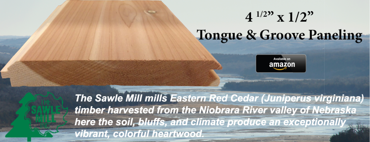
Now fully committed with a door to nowhere, I had to source the materials. I figured I’d just buy the cedar from my local big box store, but they sold thin “closet liner” material that was made to be glued or nailed into an existing closet, and I wanted something more substantial…1/2-inch tongue and groove walls and 3/4-inch tongue and groove flooring. Courtesy of Google I found a couple of sawmills that sell directly to consumers, and one of them was very interesting because of the Nebraska connection I have with the Groundwater Foundation. Here’s what I found on their website:
“The Sawle Mill buys and mills timber grown in Nebraska. Our Eastern Red Cedar (Juniperus virginiana) is primarily harvested from the Niobrara River valley where the soil, step bluffs, and climate combine to produce exceptionally vibrant, colorful, heartwood.”
https://sawlemill.com/
Curious, and interested in knowing how my choices affect the environment, I didn’t stop there. It turns out juniperus virginiana is native to the US from the Plains east to the Atlantic and south to the Gulf. It is a pioneer species, which means that it is one of the first trees to repopulate cleared, eroded, or otherwise damaged land, and it is especially long-lived. (Hmm, maybe I don’t want to cause it to be cut.) But in many areas near pasture or cropland, it is considered an invasive species, even if native. It is fire-intolerant, and used to be controlled by wildfires. Especially in Nebraska, fires have been stopped with roads, plowed fields, and other fire breaks, allowing red cedar to invade and grow where it is unwanted. (Okay, invasive is bad, so I might be helping!)


https://agronomy.unl.edu/eastern-redcedar-science-literacy-project/invasion
In the Niobrara River valley of Nebraska, there is a significant connection between groundwater and the surface flows in the river and its tributaries (something I learned through the Groundwater Foundation), so invasive trees along the river valley are using groundwater while invading the banks and bottoms. And this is where the sawmill and their customers come in: harvesting and milling red cedar trees from the Niobrara Valley helps to manage the invasive species, reduces the water use by invasive trees in the valley, and makes beneficial use of the groundwater-fed trees to create jobs and income in rural Nebraska…just like Nebraska’s other ag products.

Not to mention the end-use: beautiful, useful, aromatic, and pest-free storage closets like ours!

__________

Chris Barnett is the Executive Director of the Lawrence Community Development Corporation, as well as the team leader for the Indianapolis-Marion County Groundwater Guardian Team, the Marion County Wellfield Education Corporation. Chris also serves on The Groundwater Foundation's board of directors. Reach Chris at cbarnett.lcdc@gmail.com.


The views expressed in this blog are those of the authors and do not necessarily represent the view of The Groundwater Foundation, its board of directors, or individual members.

Thursday, February 15, 2018

BLOG: A Winter Olympics Without Water

by Jennifer Wemhoff, The Groundwater Foundation
I don't know about you, but I love the Olympics. My family has been totally into it for the past week, tuning in to sports I know nothing about but am captivated by nonetheless. These athletes make death-defying sports look easy

Last night we were watching figure skating and something struck me - every single event in the Winter Olympics relies on water. Water for the snow, water for the ice. There's no skiing without snow, there's no speed skating without ice. There's no Winter Olympics without water.

No water means no ice, and no ice means no curling,
which is perhaps my new favorite obscure sport to watch.
Water is an integral part of many recreational activities - boating, swimming, skiing. And groundwater helps feed surface water supplies for many of these (including one of my favorites - canoeing down the scenic Niobrara River in North Central Nebraska).

So as you tune into the Olympics over the next several days, think about the amazingness that is water. It freezes so a figure skater can glide gracefully over ice. It becomes snow and a snowboarder performs gravity-defying twists. Water for recreation brings enjoyment to all of our lives, even if we can only imagine competing in the Olympics.


Thursday, January 4, 2018

5 Things to Learn About Groundwater with the Awesome Aquifer Kit

by Jennifer Wemhoff, The Groundwater Foundation

The Awesome Aquifer Kit is one of the most powerful and fun groundwater education tools in our arsenal - we just add water! The Kit's design lets users "see" groundwater in ways they can't in reality.


The Kit includes a step-by-step instruction guide, definitions and explanations, and materials to teach youth and adults alike about:

1. The connection between groundwater and surface water.
The kit's gravel is used to "build" an aquifer and a lake, and water is added to it to learn about terms like recharge, water table, saturated/unsaturated zones, surface water, and discharge.

2. Wells and how they work.
By using a hand pump and tubing, the kit teaches about well siting, pumping, drawdown, depletion, and safe yield. Kids (and adults!) love to pump their aquifers!

3. Porosity and permeability.
Experiments explain different materials' capacity to store water, and have water move through them.

4. How groundwater becomes contaminated and can be cleaned up.
This is perhaps one of the most eye-opening uses of the kit - to illustrate how a contamination reaches groundwater. Food coloring and water create a contaminant plume, and the well is "pumped" to show how the contaminant moves. Activated charcoal and coffee filters are then used to "clean" the contaminated water.


The Awesome Aquifer Kit can be used in a variety of education settings, from a classroom to a water festival and everything in between. Get your Kit today!

Video demonstration
Additional Groundwater Information

Thursday, June 22, 2017

BLOG: 7 Fun Ways to Teach Your Kids About Groundwater This Summer

by Jennifer Wemhoff, The Groundwater Foundation

Summer is a time for fun and adventure. Combine those with some hands-on learning about groundwater and you've got a win-win summer activity! 

Mini-terrarium
1. Build a mini-terrarium with a clear plastic cup, gravel, potting soil, a few seeds, plastic wrap, and a rubber band (get full instructions here). Learn about groundwater's role in the water cycle and in helping plants grow. It also gives kids a plant to nurture over the summer.

2. Dig a hole. Kids love dirt. Ask them to explore the hole. Is the soil warm or cool? Is it damp or dry? How does the soil change the deeper you dig? Pour a bucket of water in the hole - where did it go? It became groundwater, filling the cracks and crevices beneath the earth's surface.

Betty Crocker website
3. Make a contamination cake. Start by baking a white cake, then turn it into a poke cake (here's a recipe for a strawberry poke cake, but you can use any flavor gelatin you want). Cut a piece of cake, and talk about how the gelatin is like contaminants in groundwater, seeping into the ground (or cake). What happened to the gelatin when it was poured onto the cake? How is this like a contaminant being poured on the ground? Talk about these things while digging into a yummy piece of cake.

Edible Aquifers
4. Another yummy - but educational - dessert activity! Make an edible aquifer. Build a simple aquifer out of ice chips, cereal, ice cream, sprinkles, clear soda, and a straw. Find the complete instructions here. Have fun and be creative! Of course, the final step is to eat your aquifer creation.

5. Build an aquifer in a cup (get full instructions here). All it takes is a clear plastic cup, rock/gravel, and water. For more fun, add a clean soap or lotion pump to simulate a well and pump the groundwater out of the model aquifer.

Visit a water body
6. Visit a local lake, river, or stream. Talk about the connections between groundwater and surface water. Groundwater contributes to stream flow, and stream flow recharges groundwater. Add a community service project to your visit and clean up litter around the water body.

7. Find a cool spot in nature. What can you discover by simply looking around and listening to the surroundings? Imagine the path taken by a drop of rain from the time it hits the ground to when it reaches a river, groundwater, or the ocean. Draw a picture and/or talk about the paths it might take.

Keep the fun and learning going this summer! For more fun educational ideas, visit www.groundwater.org/kids

Monday, March 6, 2017

BLOG: Groundwater: Out of Sight, But Not Out of Mind

by Kevin McCray, CAE, Executive Director, National Groundwater Association

Some 44 percent of the U.S. population depends on groundwater, the water that fills cracks and other openings in beds of rock and sand, for its drinking water supply — be it from either a public source or private well. In rural areas, the number is about 96 percent. That fact alone justifies the need for National Groundwater Awareness Week, to be observed this week, March 5-11, 2017. 

But groundwater is important to us in many other ways, as well. Consider:   
  • Groundwater provides much of the flow of many streams; often lakes and streams are "windows" to the water table. Groundwater adds 492 billion gallons per day to U.S. surface water bodies. In large part, the flow in a stream represents water that has flowed from the ground into the stream channel.
  • Scientists estimate U.S. groundwater reserves to be at least 33,000 trillion gallons — equal to the amount discharged into the Gulf of Mexico by the Mississippi River in the past 200 years.
  • The United States uses 79.6 billion gallons per day of fresh groundwater for public supply, private supply, irrigation, livestock, manufacturing, mining, thermoelectric power, and other purposes.
  • Groundwater is tapped through wells placed in water-bearing soils and rocks beneath the surface of the Earth. There are nearly 15.9 million of these wells serving households, cities, business, and agriculture every day. Wells are constructed by the 8,100 contracting firms employing nearly 45,000 people dedicated to providing and protecting our nation's groundwater supplies.
  • Irrigation accounts for the largest use of groundwater in the United States, about 67.2 percent of all the groundwater pumped each day. Some 53.5 billion gallons of groundwater are used daily for agricultural irrigation from more than 407,913 wells. Irrigation is a major reason for the abundance of fresh produce and grains that we all enjoy.
  • One ton of groundwater used by industry generates an estimated $14,000 worth of output.
These facts help us connect with the important role we each play as stewards, or protectors, of groundwater. Man can adversely affect the resource. Fortunately, there are simple steps that will help protect groundwater and the wells systems that distribute it.
  • Always use licensed or certified water well drillers and pump installers when a well is constructed or serviced, or when the pump is installed or serviced.
  • Keep hazardous materials away from any well. Never dump such materials, motor oil, or anything else that could impact water quality onto the land surface, into a hole or pit, or into a surface water supply.
These tips and more are available from sources such as a state groundwater or water well association, NGWA, or from your county agricultural extension agent or state government agency with responsibility for groundwater. A convenient source for a broader understanding of our groundwater protector role can be found at www.wellowner.org, a Web service of NGWA.

National Groundwater Awareness Week is not a celebration such as the Fourth of July has become. Instead, we should use the week to reflect more deeply on groundwater's value and its contributions to our lives.