Showing posts with label best management practices. Show all posts

Wednesday, November 28, 2018

It's Water-Wise Wednesdays with Frannie the Fish! {#TBT: Let's Keep Winter Clean!}

It looks like winter is finally here to stay! Have fun, stay warm, and enjoy this post from last year on how to be a good steward of the earth while staying safe on the slippery sidewalks.


With so much snow and ice on the ground, it’s important that we stay safe on our way to work or school.  Many cities use big trucks carry loads of salt and sand to spread on the roads and sidewalks.  This mixture melts ice and prevents it from forming again so that we can travel around without slipping.


Once the ice is melted, though, the water mixes with the salt and the runoff can cause the groundwater and surface water to become contaminated.  Here’s some ways you can help limit contamination from your home this winter.

1. Shovel early and shovel often. Frannie thinks its fun to shovel snow when it's not too thick and heavy.

2. To limit salt pollution, don't use too much salt or ice-melt. You only need about a handful for each square yard of concrete and using more doesn't actually work better.

3. Sand and kitty litter can stop you from slipping, but they don't melt snow.  Too much of it can even clog sewers, so remember to sweep up and throw away any extra that is left after the ice is gone.

4. Try an eco-friendly alternative to ice-melt and sand such as cracked corn, alfalfa meal, or beet juice.  While you should still be careful not to over-use them, these ingredients are shown to be less harmful than traditional ice treatments.

We can have fun, stay safe, AND keep winter clean together!

Wednesday, May 30, 2018

It's Water-Wise Wednesdays with Frannie the Fish! {Irrigation: Agricultural Systems}

This is the second part in Frannie's exploration of irrigation. Check out the first part here!
---

Over 40% of the world's food supply is farmed on irrigated cropland. Crops and livestock are how farmers make their living.  While it's important to produce as much as they can to make money, it also costs a lot of money to keep the plants and animals healthy and farmers are always looking for new ways to reduce operating costs.

Management practices can include reducing their irrigation cycle by starting later or ending sooner that is usual as well as restricting irrigation to the cooler hours of the day, either in the morning or at dusk.  But different types of irrigation systems can also offer many kinds of benefits to the farmers and crops. Let's investigate some of the most common systems.

Surface irrigation
Water is distributed over and across land by gravity. It's one of the oldest and most common types of irrigation, very easy and cheap due to the lack of mechanical pump. However, because water is simply flooding over the surface, a large percentage of the water is wasted through runoff and evaporation.

Drip irrigation
A type of localized irrigation in which drops of water are delivered at or near the root of plants. In this type of irrigation, evaporation and runoff are minimized.  It is more expensive to install than most other types of irrigation, however, and if the water is not kept clean, the tubes themselves may clog and be more difficult fix or replace.

Center pivot irrigation
Water is distributed by a system of sprinklers that move on wheeled towers in a circular pattern. This system is common in flat areas of the United States. Current technology allows farmers to control their pivot's operation with a smartphone, tablet, or computer. Soil moisture sensors, GPS, and GIS can help determine how and when to irrigate efficiently and effectively.

Lateral move irrigation
Water is distributed through a series of pipes, each with a wheel and a set of sprinklers, which are rotated either by hand or with a purpose-built mechanism. The sprinklers move a certain distance across the field and then need to have the water hose reconnected for the next distance. This system tends to be less expensive but requires more labor than others.

Sub-irrigation
Water is distributed across land by raising the water table, through a system of pumping stations, canals, gates, and ditches and excess water may be able to be collected for reuse. This type of irrigation is most effective in areas with high water tables.

Wednesday, May 16, 2018

It's Water-Wise Wednesdays with Frannie the Fish! {Irrigation: What is it and Why is it Important?}

Especially in the hot, dry summer months, plants need water to keep growing and producing food.  At home, we have to remember to water our house and garden plants. Farmers have to remember to water, or irrigate, acres and acres of crops.

Irrigation is a fancy word for watering plants to help them grow.  Of course it’s important to water plants when it’s hot out, but farmers also use irrigation to help increase crop density, or the number of crops that can be grown in an area.

Farmers are in the business of water.  Healthy crops need water and a lot of healthy crops need a lot of water. Farmers practice smart irrigation techniques that help save themselves thousands of dollars each year.

Did you know that 40% of the world's food supply is farmed on irrigated cropland? And almost half of that is land lies within China, India, and the US. In the early days of irrigation, very little water conservation equipment or technology was available and large amounts of water were lost to evaporation or runoff.  

Technology has advanced significantly to maximize water efficiency. Some practices are simple and are things you probably do at home, such as watering during the coolest parts of the day to reduce evaporation. Some tools however, such as center pivot systems, use software on computers and mobile devices to control how much water crops receive, where the water goes, and when the irrigation system is turned on or off.
Visit The Groundwater Foundation's website to learn more about irrigation and check back on Wednesdays as Frannie explores how groundwater and irrigation help grow the food we eat. 


Wednesday, January 10, 2018

It's Water-Wise Wednesdays with Frannie the Fish! {Wellhead Protection: What is it?}

This is Part 1 in Frannie's exploration of Wellhead Protection.   Look for her upcoming blogs to learn more about what it is, who protects the wellheads, and why it's important.

----

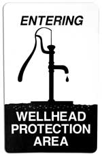
Frannie is learning more and more about how to protect the groundwater in her community.  Recently, she saw a sign just outside of her city that said "Wellhead Protection Area".  She didn't know what that meant, so she went to The Groundwater Foundation's website to find out.
"Wellhead protection" is a fancy term for the idea that we should protect the land around the area where a community gets their water. Many communities use wells to withdraw groundwater and then transport it to a water treatment plant where they treat it and pipe it into the public water system.  Growth and development in a community is important, but it also brings the potential to deplete or contaminate the water everyone drinks.
Each state has a different approach to wellhead protection but will generally involve 5 key points:
1) Delineating the Wellhead Protection Area.  Several maps, containing data on groundwater flow and geology and geographic boundaries, are combined into a single map that determines the land area that could influence the groundwater supply.
2) Conducting a Potential Contaminant Source Inventory. This just means that information is collected about all of the sources in the areas that could potentially contaminate the groundwater.  This may include farms, gardens, factories, or other types of industry.
3) Contaminant Source Management. All of the information that was collected in the Potential Contaminant Source Inventory is put to use to develop best practices where businesses can safely use their materials without threatening the groundwater.
4) Contingency Planning. No wellhead protection plan is complete without a plan for the worst case scenario.  In the event of a well that has to be shut-down due to contamination, natural disaster, physical breakdown, or any other cause, a community must have an idea of short-term and long-term drinking water supply replacements.
5) Education. A community is made up of it's people, so ultimately it is the people in the area who have to protect their water.  A community should make their wellhead protection plan available to the public as well as provide workshops or opportunities on social media for people to learn about the plan.

Wednesday, July 26, 2017

It's Water-Wise Wednesdays with Frannie the Fish! {Food Waste Part 1: Composting}

Food is an integral part of the water cycle.  Plants need water to grow.  Animals need plants to eat and water to drink.  The big trucks need water to keep their engines cool on the long interstate drives from the farm to the store to the table.  You even use water to clean and cook your food.

We know it’s important to Reduce, Reuse, and Recycle, but did you know you can do that with your food, too?

Food waste is the name for our leftovers after we’re done preparing, cooking, or eating our food.  In this mini-series, Frannie will look at different ways that we can reduce, reuse, and recycle food waste.


Composting is one of the easiest way to reuse food waste from fruits and vegetables.  It reduces the volume of trash we put into landfills while creating nutrient-rich soils we can use to grow beautiful, healthy plants.

It starts with a box. Or a bin. Or hole in the ground. Or even just a pile in the corner of your yard that is out of the way and people know not to step in.  Any way you have it, the important part of the pile is the worms and fungi and bugs, decomposers that will take whatever you put into your compost and turn it into the dirt you want at the end.
 
Once you have your compost pile or box or hole, you can start putting things in there.  But wait, you can’t put all of your food waste in the compost.  Only put plant-based items in your bin, such as nut shells, fruit and veggie peelings, grass clippings, and weeds.  Things you should not put in your compost include meat, dairy, oils, or fats because they might attract some pests you don’t want near your home.

Once you have added your first compostable materials, cover them with soil or some already completed compost.  This will kick-start the decomposing process by introducing the worms and microbes (little bacteria) to the fresh scraps.

Add a little water for moisture, turn or stir it once a week, and voila! Your composted soil should be completely done and ready to use in just a couple months! Of course you can always add to the top of the pile and scoop out the finished compost at the bottom to keep the process going.

Like Frannie said before, the finished product that comes out of a compost pile is a nutrient-rich soil that you can use to start new seedlings or spread on the top of your garden like a fertilizer.


Share pictures of your compost piles and gardens for a chance to be featured in an upcoming blog! Happy Gardening!

Wednesday, June 28, 2017

It's Water-Wise Wednesdays with Frannie the Fish! {Groundwater Restoration}

If an aquifer becomes contaminated or overdrawn, then the people, animals, and plants living on top of it are in serious trouble.  We know that it is important for groundwater to be recharged through natural means like rain and snow, but is it possible for humans to help put the aquifer back in its original condition?

It is! We do this through a process called Aquifer Restoration. This process is done usually by the utilities department of cities and towns or by Natural Resources Districts.  Many people including engineers, data analysts, well drillers, and geologists have to work together to make the groundwater safe again.

Nitrate Concentration Map
for Hastings, NE 2015
Credit: Hastings Utilities
Let’s take a look at Hastings, Nebraska which is just finishing up Phase 1 of their Aquifer Storage and Restoration Project.

Hastings’ water system gets most of their water from the Ogallala and High Plains Aquifer and they do not currently treat, chlorinate, or store their water but they have started to experience problems with nitrates, volatile organic compounds, and uranium. 

In order to continue to provide usable water, Hastings’ Utilities team initiated the Aquifer Storage and Restoration (ASR) project in 2016.  They built dual pumping wells which help clean up nitrates and uranium floating that the top of the aquifer, a reservoir for managing irrigation, and are just beginning to construct reverse osmosis treatment centers to help consolidate and remove pollutants.


The reservoir holds enough water
 to fill 66 Olympic pools.
Credit: Hastings Utilities
Over the next few years, they plan to study recharge in the area and investigate why groundwater recharges faster in some parts of the city than in others.  They are combining research with restoration to make sure that their city has clean water and residents understand the need for and purpose of the ASR project.  To learn more, check out Hastings Utilities website.


To learn more about groundwater and try your own aquifer restoration activity, visit The Groundwater Foundation’s Groundwater Restoration website.

Wednesday, June 14, 2017

It’s Water-Wise Wednesdays with Frannie the Fish! {Awesome Aquifer Kit: Improperly Managed Landfill}

This week in Frannie’s exploration of the Awesome Aquifer Kit is all about why you should care what goes into your landfill.
 
We all know how to pick up litter and throw it away properly, but where does our trash go and how is it taken care of after the garbage truck drives away?

That’s right! The landfill!

All of the gross things we don’t want near are homes are going to a landfill.  When it rains, the water infiltrates the landfill.  In other words, it filters down through all the layers of trash to reach the earth.  Once the water has trickled down through all that trash, it starts to look and smell like a garbage soup.  Scientists call this soup “leachate”.

Leachate then seeps down into the ground where it can interact with our groundwater, the same water we pull from our wells to drink and use in preparing our food.  If we are not careful of what we put in the trash or if the operators of the landfill are not careful to check the garbage trucks for harmful and toxic items, then our wells are in danger of critical pollution.

Luckily, there are special landfills for dangerous chemicals.  These can be underground storage tanks, septic systems, or recycling plants that treat or transform toxic trash until it is useable again.  You can help at home by doing more recycling, even for items like broken electronics, batteries and light bulbs!

You can learn more about landfills here and visit your local landfill to see what they are doing to keep your ground and groundwater safe.

Friday, April 7, 2017

BLOG: BMPs - An Industry's Response

by William Bieck, Heritage Hills Golf Course

“When disagreement or conflict is imminent, it’s better to be proactive than reactive.” 

This is an often used statement that recognizes it is better to correct problems before they exacerbate into a more difficult dilemma. It is easy for Golf Course Superintendents in the turf industry to discuss, debate, and share stories of new regulatory policies and the difficulties and costs to achieve compliance. But, when we “speak to the choir” amongst ourselves, we are not communicating to those who really decide our fate. Superintendents and the golf industry do not legislate...the government does.

This fact alone should compel those dependent on the golf industry or other industry that is under heightened scrutiny to share their strategies and positive environmental stories to those outside their circle of influence. I have been a golf superintendent for over 42 years and consider myself a strong advocate for environmental stewardship. As an industry, I have seen the Golf Course Superintendent’s Association of America (GCSAA) support its members with unlimited access to educational resources pertaining to environmental protection, conservation, and research. The golf industry has responded very positively to water issues. Over the past several decades, turfgrasses have been developed that can tolerate drought or poor-quality water. Technology advancements in irrigation equipment have greatly improved irrigation efficiency and uniformity resulting in less water use. Still, even with all these efforts to protect and sustain our environment, the golf course industry is commonly perceived to be a significant source of pollution and bad for the environment. These comments are simply not true and this perception needs to change in order to improve golf’s image.

In response, the GCSAA is increasing their emphasis not only to educate its members to the importance of responsible and sustainable stewardship, but to also share golf’s positive environmental stories with everyone, including detractors. 

BMPs, Best Management Practices, are the adoption of science-based agronomic practices that support proactive environmental stewardship. BMPs are a tool that will demonstrate to legislators, regulators and consumers the environmental policies that will augment trust and credibility into our management programs. BMP programs help superintendents manage golf facilities in an efficient manner while providing quality playing surfaces and protecting the environment. They also enable the golf course facility to operate where regulatory pressures exist, and they offer the industry a significant platform for advocacy, education, recognition, and demonstration of professional land management.

GCSAA has also recently launched an aggressive initiative of offering a BMP Planning Guide and Template to its state chapters to help develop and customize fundamental BMPs according to each state’s needs and requirements. It is the goal of the GCSAA to establish BMPs in all 50 states by 2020, a lofty goal that illustrates a sincere commitment to environmental improvement.

Credit: GCSAA

BMPs will address the many facets of golf course management. They are the method or techniques found to be the most effective and practical means of achieving an objective, such as preventing water pollution or reducing pesticide usage. Topics will include wellhead protection, irrigation efficiency, wetland protection, nutrient management, pesticide management, and surface and groundwater monitoring, conservation and protection.

Credit: GCSAA

Why use BMPs as a format to persuade golf’s detractors, environmental activists, and policy makers?  BMPs are the shared language recognized by regulators, conservationists, engineers and others as a means to driving improvements. It is important to note that BMPs are recognized in federal and state TMDL (total maximum daily load) policy as a major component of water quality improvement plans.

Credit: GCSAA

By implementing these practices, each facility will demonstrate to state regulatory agencies that their management practices are science-based and environmentally sound. By allowing governmental regulatory and compliance agencies to be involved in drafting these BMPs the industry has encouraged an open dialogue leading to positive changes that can have a significant impact on TMDLs and other measurable components. The end result of a successful BMP will be a healthy golf facility and a management plan that supports environmental improvement.

BMPs are the response of the golf industry to achieve a greater legitimacy and credibility. Many facilities will implement BMP approaches not just in reaction to mandated regulations, but as a proactive environmental stewardship business policy, that is, the best operations strategy for sustainability of the environment and the golf business.

William K. Bieck, CGCS, is the Course Operations Manager for Heritage Hills Golf Course in McCook, Nebraska. Heritage Hills was one of the pilot sites participating in the Groundwater Guardian Green Site program, and has been designated every year since. Reach Bill at maint1@heritagehillsgolf.net.

Wednesday, January 25, 2017

It's Water-Wise Wednesdays with Frannie the Fish! {Let's Keep Winter Clean!}

Brrrr!!!

With so much snow and ice on the ground, it’s important that we stay safe on our way to work or school.  Many cities use big trucks carry loads of salt and sand to spread on the roads and sidewalks.  This mixture melts ice and prevents it from forming again so that we can travel around without slipping.


Once the ice is melted, though, the water mixes with the salt and the runoff can cause the groundwater and surface water to become contaminated.  Here’s some ways you can help limit contamination from your home this winter.

1. Shovel early and shovel often. Frannie thinks its fun to shovel snow when it's not too thick and heavy.

2. To limit salt pollution, don't use too much salt or ice-melt. You only need about a handful for each square yard of concrete and using more doesn't actually work better.

3. Sand and kitty litter can stop you from slipping, but they don't melt snow.  Too much of it can even clog sewers, so remember to sweep up and throw away any extra that is left after the ice is gone.

4. Try an eco-friendly alternative to ice-melt and sand such as cracked corn, alfalfa meal, or beet juice.  While you should still be careful not to over-use them, these ingredients are shown to be less harmful than traditional ice treatments.

We can have fun, stay safe, AND keep winter clean together!

Friday, October 28, 2016

BLOG: First Groundwater Focused Plan to Address Nonpoint Pollution

by Sam Radford, Wellhead Protection Program Coordinator and Laura Johnson, Integrated Report and TMDL Coordinator, Nebraska Department of Environmental Quality

The spotlight is on Nebraska as the EPA recently approved the Bazile Groundwater Management Area (BGMA) Plan. The BGMA Plan is the first groundwater focused plan in the nation to address nonpoint source pollution. The plan is the result of a collaborative effort to reduce groundwater nitrate contamination between the Nebraska Department of Environmental Quality (NDEQ) and four of Nebraska’s Natural Resources Districts (NRDs): Lewis and Clark, Lower Elkhorn, Lower Niobrara, and the Upper Elkhorn. The approval of this plan provides NRDs, Communities, and other Public Water Systems (PWS) an innovative framework to build upon, and new funding sources to protect the BGMA Wellhead Protection (WHP) Areas, as well as WHP Areas across the state.

Figure 1
The BGMA covers 756 square miles in northeast Nebraska and is home to 10 communities and over 7,000 residents (see Figure 1). Groundwater in the BGMA is the only drinking water source for communities and rural residents. Extensive row crop and sandy soils have allowed nitrate from land applied manure and commercial fertilizer to leach into the groundwater. The NRDs have collected data on groundwater nitrate concentrations since 1980. During that time, average nitrate concentrations have increased with some areas exceeding 30 mg/L, three times the levels safe for drinking water.

The plan focuses on reducing groundwater nitrate levels below 10 mg/L by progressively adopting more protective Best Management Practices (BMPs) throughout the BGMA. Community Wellhead Protection Areas are listed as the highest project funding priority. The NRDs will utilize a combination of agricultural BMPs required by elevated Groundwater Management plan phases, and voluntary BMPs outlined in the BGMA plan that go above and beyond phase requirements. Through the development of the BGMA Plan, the NRDs have created a cohesive strategy to monitor nitrate reductions in groundwater as fertilizer practices and irrigation methods are improved in the area. This monitoring data will also further refine future versions of the BGMA plan to ensure its goals are achieved.

To truly understand the significance of this plan, one must understand the history of water laws in Nebraska as well as at the federal level. In the past, groundwater and surface water were thought to be two separate water sources and were therefore regulated by separate water laws. At the federal level, the Clean Water Act (CWA) of 1972 charged the US EPA to regulate point source pollution to surface water. While the CWA began to successfully reduce point source contamination, it failed to effectively address nonpoint source contamination. In 1987, the CWA was amended, and the Section 319 Nonpoint Source Management Program was established to improve federal leadership and support, and focus local efforts on voluntarily reducing nonpoint source contamination (EPA 2016). Even with the 1987 amendment, the CWA act did not directly speak to groundwater, leaving management of groundwater resources to the states. Nebraska has been managing and regulating groundwater resources through the NRDs since the mid ‘70s. However, the hydrologic connection between surface and groundwater wasn’t legally recognized until 1996.This acknowledgement has led Nebraska to collaborative efforts that address nonpoint source contamination from a different perspective than what is generally found at the federal level.

The BGMA plan is the first EPA approved plan in the nation to address nonpoint source groundwater quality problems using the Clean Water Act. This is a milestone for communities who have struggled to obtain funding for projects that seek to educate and inform residents and local producers; and implement BMPs targeted at reducing nonpoint source groundwater pollution in their Wellhead Protection Areas. Until now, CWA Section 319 funding was only used on projects that address impairments in surface water or in areas that were listed as priority areas in a NRD’s watershed management plan. While more and more WHP areas are being targeted in watershed management plans, the BGMA plan is the first to address it from the standpoint of groundwater and to make WHP areas a priority for project funding.

Nebraska is unique in that approximately 88% of the state’s residents, and nearly all rural residents, primary source of drinking water comes from groundwater (NDEQ 2015). The geology, hydrology, and depth to groundwater determine how susceptible groundwater aquifers are to contamination. For example, sandy soils, little or no protective surface layers (i.e. clay or glacial till), and/or high groundwater tables leave drinking water aquifers especially vulnerable to point and nonpoint source contamination. The rate of groundwater movement ranges from inches per year(s) to inches per decade(s) compared to surface water which moves inches per day(s) to week(s) to enter surface waterbodies.

Table 1
Nonpoint source groundwater nitrate contamination is one of the most prevalent nonpoint source contaminants in Nebraska. It puts a heavy financial burden on communities and their Public Water Systems, as the only way to remove nitrate from drinking water is through treatment. In the last 20 years, five PWS and landowners with private wells in the BGMA have spent over $9 million dollars on treatment (see Table 1). This amount includes the cost of facility operations and maintenance (O&M) and point of use (POU) treatment systems for domestic well owners. Ultimately, the cost of treatment and O&M falls on the 4,201 residents that reside in the five affected communities and land owners in the surrounding area. In the future, the cost of treatment will only increase if the source of contamination is not addressed (NDEQ 2016). Nitrate contamination is prevalent throughout Nebraska and many other communities are dealing with the same problems as those in the BGMA (see Figure 2). This is just one example of why the work that has been done and will continue to be done in the BGMA is so important. Hopefully, the plan will pave the way for many other NRDs and communities to better respond to and manage nonpoint source contamination, especially in WHP areas.
Figure 2

The approval of the BGMA plan by the EPA has provided an entirely new source of funding that wasn’t previously available for groundwater and drinking water protection efforts. Since the creation of Nebraska’s voluntary Wellhead Protection Program, communities and PWS across the state have had the ability to create WHP protection plans to protect their drinking water sources. These plans identify possible sources of contamination in the WHP area and lay out management strategies to address sources of contaminants. The ultimate goal is to implement on-the-ground activities such as BMPs and education and outreach programs. More often than not this goal falls short as no direct funding is available to communities. Many communities do not have the time, support, education, or money needed to develop and implement effective WHP plans. Until now, the only financial assistance NDEQ has been able to give communities who wish to protect their drinking water sources are Source Water Protection (SWP) Grants. The grant program distributes up to $100,000 a year, which generally isn’t enough to fund multiple larger more involved projects. The SWP Grant has been limited in its ability to support long-term efforts to reduce nonpoint source contamination. The NDEQ is hopeful that communities will be able to better protect their drinking water sources through CWA Section 319 funding.

The BGMA plan approval by the EPA has also led to new activities for the SWP Grant to fund. As stated previously, the BGMA plan is the first in the nation to focus on ground water instead of surface water. Because most Nebraska communities use groundwater as a source for their drinking water, those communities were not included in earlier watershed management plans nor were they eligible for funding on their own. In response to the EPA approval of the BGWMA plan, the NDEQ is working with communities and the EPA to develop Drinking Water Protection Management (DWPM) Plans. These plans will be similar to the BGMA plan in that they will primarily be groundwater focused plans that specifically target WHP areas. These plans will:
  • Meet EPA requirements for alternative 9-element watershed management plans
  • Increase WHP area delineations from 20 to 50 year delineations using three-dimensional groundwater models
  • Include strong implementable Information and Education programs
  • Use community based planning processes to develop the plan

Currently three Nebraska communities are in the process of developing DWPM plans. Two through the 2016 SWP Grant and one proposed project that will combine available 319 planning money and other grant sources. The ability to independently qualify for 319 project funding would provide a much needed funding stream to the many struggling communities in Nebraska. These new opportunities would not be possible without the innovative work that was done on the BGMA plan. The NDEQ looks forward to working with Nebraska communities to protect and improve their drinking water.

A special thanks to the BGMA stakeholders and the many individuals from various local, state, and federal organizations for their contributions to the development of this plan.

You can view the plan at http://deq.ne.gov/publica.nsf/pages/16-013 and learn more about Drinking Water Protection Management Plans by visiting http://deq.ne.gov/NDEQProg.nsf/OnWeb/SWPGMain. Select the Invitations for 2016 Source Water Protection link and open the fact sheet PDF.

Sources:
EPA, 2016. Polluted Runoff: Nonpoint Source Pollution Webpage, https://www.epa.gov/nps/319-grant-program-states-and-territories

NDEQ, 2015. 2015 Nebraska Groundwater Quality Monitoring Report, 5 p. http://deq.ne.gov/publica.nsf/PubsForm.xsp?documentId=8DE603FF6ACDF2C086257F1100578674&action=openDocument.

NDEQ. 2016. Bazile Groundwater Management Plan, 42 p, http://deq.ne.gov/publica.nsf/pages/16-013.

Tuesday, October 4, 2016

BLOG: We Get By With a Little Help

by Kirk Welch, North Plains Groundwater Conservation District, Dumas, Texas

In the immortal words of John and Paul, “I get by with a little help from my friends.” The famous song by the Beatles probably didn’t specifically consider the challenges of water conservation outreach, but you get the idea. The point here is, that at one time or another, we all need a little help. In the world of groundwater conservation outreach, it’s sometimes more than a little.

As the assistant general manager in charge of conservation outreach for the North Plains Groundwater Conservation District (GCD), I find that often times the scope of the great ideas we have for extending the reach of groundwater conservation, far exceeds our ability to realize on our own. Whether it’s an idea for an award-winning agricultural demonstration, birthed as a friendly wager amongst our board members, or a project initiated by my predecessor, like our “Save the Planet’s Water Festival”, many of the district’s projects require partners. 

The district was formed in 1955 and celebrated its 60th Anniversary in 2015. It covers all or part of the eight northern most counties in the Texas Panhandle with the southern boundary roughly following the Canadian river. The district encompasses about 7300 square miles overlaying the Ogallala aquifer throughout, as well as the Dockum and Rita Blanca aquifers. The district has about 1,000,000 acres of irrigated cropland and some of the highest groundwater producing counties in the State of Texas. The water table is dropping an average of 2-3 feet a year across the district. Consequently, the heavy reliance on the declining Ogallala aquifer makes conservation a necessary way of life in the North Plains GCD, and we can’t do it alone.

One project that would be absolutely impossible without partners on all sides is the district’s Save the Planet’s Water Festival. Started in 2005, the festivals have hosted almost 6,000 4th graders for this full day of interactive water and natural resource conservation education. Beginning with one festival in Dumas the first year, a festival was added in the town of Perryton in 2006 and finally in Dalhart in 2011. The “Save the Planet’s Water Festivals” are made possible by community partners including Valero Energy, Frank Phillips College, United States Department of Agriculture (USDA) - Natural Resources Conservation Service (NRCS), West Texas A&M University, Texas A&M Agrilife Extension, Texas Parks and Wildlife, Panhandle Groundwater Conservation District, all of the area’s school districts and many private schools, as well as many individual volunteers.

Agriculture conservation demonstration is another extremely resource intensive initiative of the district. Since roughly 95-percent of the groundwater produced in the district is used for irrigation, the board of directors, in 2009, began talking about how the district could demonstrate how agricultural users could conserve, while maintaining viable irrigated operations. The “200-12 Project,” based on the goal of producing 200 bushel corn crops with only 12-lnches of supplemental irrigation, was born out of a challenge between board member/growers who wanted to see who could be the most efficient.

Since beginning as a district-funded demonstration with board members as the only participants in 2010, the “200-12 Project” has received funding from both the Texas Water Development Board (TWDB) and the USDA – NRCS, and has involved many of the most progressive farmers in the northern Panhandle, including four members of the district board of directors. In 2015, the district's agriculture demonstrations were energized by a unique private/public partnership with Crop Production Services of Loveland, CO to cooperate in the operation of the district's North Plains Water Conservation Center (WCC). The 320 acre working farm is a showcase for agricultural water conservation strategies and corporate partner, CPS, along with local grower Stan Spain have worked side-by-side with the district to develop this unique project.

The “200-12 Project” received the NRCS Conservation Innovation Grant as part of the Texas High Plains Initiative for Efficient Irrigation Management and Conservation (Texas High Plains Initiative). The Texas High Plains Initiative was a cooperative effort between the district’s “200-12 Project” and the Texas Alliance for Water Conservation, including Texas Tech University, High Plains Underground Water Conservation District and others. With demonstrations spanning the High Plains from north to south, the Texas High Plains Initiative helped extend the reach of the conservation mission through out the region.

After several years of demonstration projects showcasing many best practices in agricultural water conservation, the board of directors wanted to take the next  step to move the initiative from demonstration to producer adoption. Recognizing that one of the biggest obstacles in adoption is the learning curve involved with many of the conservation strategies and technologies, the Master Irrigator program was created as a way to shorten that curve for a group of committed, influential producers. The Master Irrigator curriculum is made up of 4-5, full-day sessions and covers the topics of residue management; remote pivot monitoring and control; irrigation management using soil-moisture probes, telemetry and irrigation scheduling tools; managing irrigation with planting date; use of low-energy precision application irrigation or other high-efficiency delivery system; and adjusting nutrient application to address reduced irrigation. In addition, each session includes the economic implications of the strategies being presented. In its first year, the program attracted a full complement of 25 progressive growers from the area.
Again critical partnerships were instrumental in the success of this project. First, USDA- NRCS agreed to provide a special $1.6 million fund to support the Master Irrigator program. The fund is part of the Environmental Quality Incentive Program, and participants in Master Irrigator are given priority ranking for this special pool of funds. In its first year, over $400,000 were distributed to local growers to implement conservation practices, as a result of their participation in the Master Irrigator program.  Second, Texas AgriLife Extension provided essential technical assistance in program development and content.
These are just a few of the projects in which we proudly partner with industry, academia and the public to further the cause of conserving, protecting and preserving groundwater in the district.
However, I would definitely be remiss in talking about valuable partnerships if I did not include the district’s long-standing relationship with the Groundwater Foundation. The district has been a Groundwater Guardian (GG) Community since 2005. The foundation is a valuable resource for ideas, inspiration and support. The GG program, encourages members to organize like-minded partners within their communities to come together to promote groundwater conservation. The foundation conferences also offer opportunities to network and appropriate, borrow, or out-and-out steal the best ideas for your next initiative. Also, observing the achievements of other Groundwater Guardians inspires us to try new things, look at our existing projects in different ways and ultimately, to be more effective.

And last, but certainly not least, the GG designation in itself has a couple of very important benefits. First, preparation of the annual entry and status reports provides an opportunity for GG Communities to take inventory of, and a critical look at, the merits of each of our projects and programs. The changing dynamics of regulation, communication and various technologies, just to name a few, may determine whether a project needs minor adjustment, a major overhaul, or needs to be scrapped altogether. Second, the public relations benefits of a third-party endorsement of what we are doing, reinforces the credibility and relevance of our organizations.

So, I commend all our fellow conservationists and thank you for any and all ways you have aided my group, or any other, in the cause of groundwater. If you have not worked with one or more of the previously mentioned groups, I would suggest you give them a try. If you have worked with some that I have not listed here, it sounds like we need to talk! We get by with a little help!


__________


Kirk Welch is the Assistant General Manager – Outreach at North Plains Groundwater Conservation District in the northern Texas Panhandle. He has worked for the last 28 years as a communications professional in television news, telecommunications and healthcare education, including the last seven years telling the story of groundwater conservation in the Texas Panhandle. He also serves on The Groundwater Foundation's Board of Directors. Reach him at kwelch@northplainsgcd.org.

The views expressed in this blog are those of the authors and do not necessarily represent the view of The Groundwater Foundation, its board of directors, or individual members.

Monday, September 26, 2016

BLOG: Protecting Groundwater Through Personal Contact and Best Management Practices

by Chris Barnett, Executive Director, Lawrence Community Development Corporation, Lawrence, Indiana

Indianapolis-Marion County, Indiana has been a Groundwater Guardian Community since 1998.  We recognized the value of The Groundwater Foundation’s programs even before that:  in the early 1990s, when the original team was helping to write our first Wellfield Protection Zoning Ordinance, the Foundation was able to provide us with examples of ordinances and regulations from other communities.

Our team is an all-volunteer board, which is legally structured as a 501c3 not-for-profit “supporting organization” to city-county government.  We contract with an environmental consulting firm to take care of two main responsibilities:  keeping a registry of the “potential contaminant sources” (commercial locations that use and store potential contaminants) in our seven wellfield protection areas, and working with those businesses to employ best practices and minimize risks to the water supply.  Our third main responsibility, which the board undertakes in cooperation with our consultant, is providing speakers and task force members to advise citizens and city-county government on a wide range of topics around groundwater protection.  Our association with The Groundwater Foundation and our long-time Groundwater Guardian recognition adds credibility to our message.  We highlight our Guardian status in presentations, reports, our website, and the printed materials we distribute to businesses.

Our universe is large.  Marion County is an urbanized county of approximately 400 square miles with an estimated population of 939,000.  The vast majority of residences and commercial establishments are served by the municipal water systems of Citizens Water, Lawrence Utilities, and Speedway Water Works.  The rest utilize private wells.  The City of Lawrence and its 47,000 residents are 100% groundwater-dependent.  The Town of Speedway, home to about 13,000 residents and the Indianapolis Motor Speedway, switches from part-surface to all-groundwater in winter when its surface water source becomes unreliable.  About 20-25% of Citizens Water production is groundwater, and that figure is growing with population and new connections.

Our program is voluntary and advisory, as local zoning ordinances can impose design and construction requirements but not operating requirements on businesses.  So our audience is generally limited to commercial/industrial property owners and operators, as well as city government and public health officials.   We stress personal contact and utilizing best management practices to reduce groundwater contamination risk within our wellfield protection districts.


The wellfield districts are set by ordinance as the 5-year time of travel zones around the public water supply wells in the county.  The wellfields encompass about 15% of the county’s land area.  On the map above, the 5-year TOT boundary is the white area; the dark gray area is the 1-year TOT.  Within these areas, there are 2,645 non-residential sites.  About half of the sites are judged to pose little or no risk to groundwater; 696 properties are regulated (or formerly-regulated) sites, and 681 more are unregulated but have commercial operations that could potentially pose a threat to groundwater.  Tracking the commercial uses and maintaining the registry database is a large undertaking, as is the effort to establish face-to-face communication with those businesses.

MCWEC consultant John Mundell addresses the
Riverside Area Superfund informational meeting.
Earlier in 2016, MCWEC directors and consultants mobilized to help organize and present information in a community meeting to address a proposed Superfund site in the midst of a high-production wellfield area.  Historic contamination suspected to be from commercial or industrial uses has been detected in raw water samples at production wells of Citizens Water.  The Indiana Department of Environmental Management worked with USEPA to study the issue, and the result was a proposed Superfund NPL designation.  Such designation in a drinking water protection area overlaid with a combination of residences and businesses carries both advantages and disadvantages.  We believe that the information presented by MCWEC helped community members who were present to better understand how they might respond to the proposed designation.

__________

Chris Barnett is the Executive Director of the Lawrence Community Development Corporation, as well as the team leader for the Indianapolis-Marion County Groundwater Guardian Team, the Marion County Wellfield Education Corporation. Chris also serves on The Groundwater Foundation's board of directors. Reach Chris at cbarnett.lcdc@gmail.com.

The views expressed in this blog are those of the authors and do not necessarily represent the view of The Groundwater Foundation, its board of directors, or individual members.